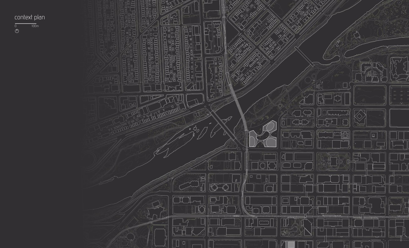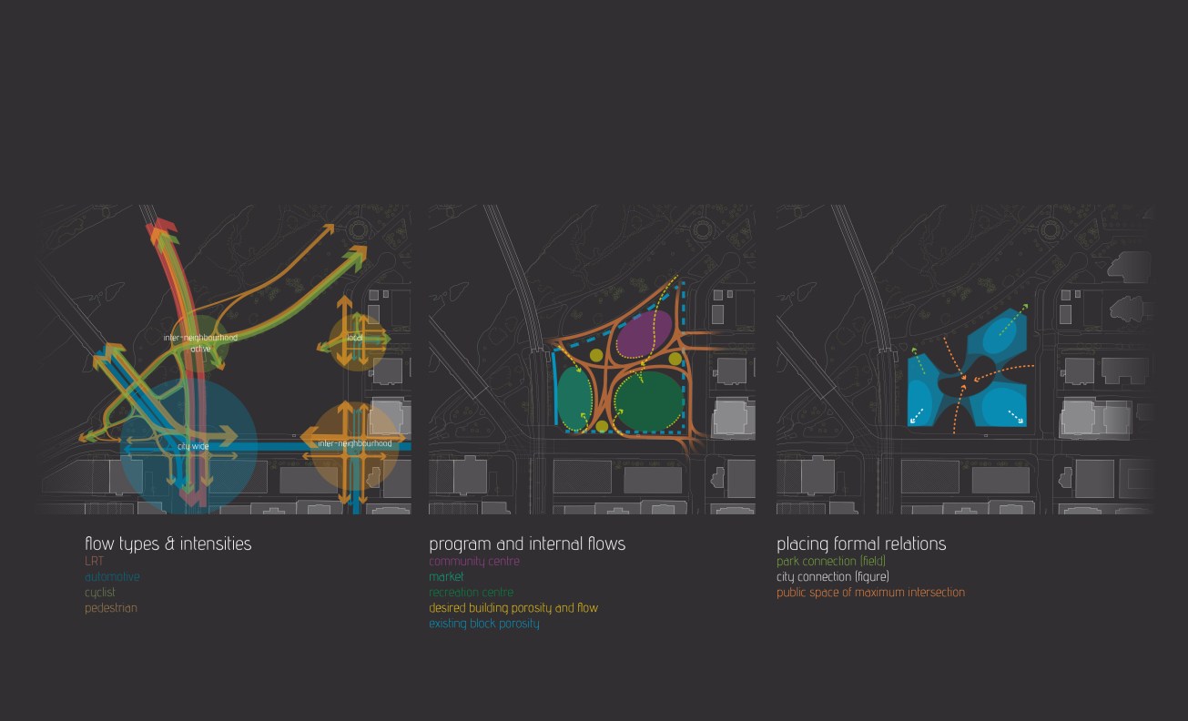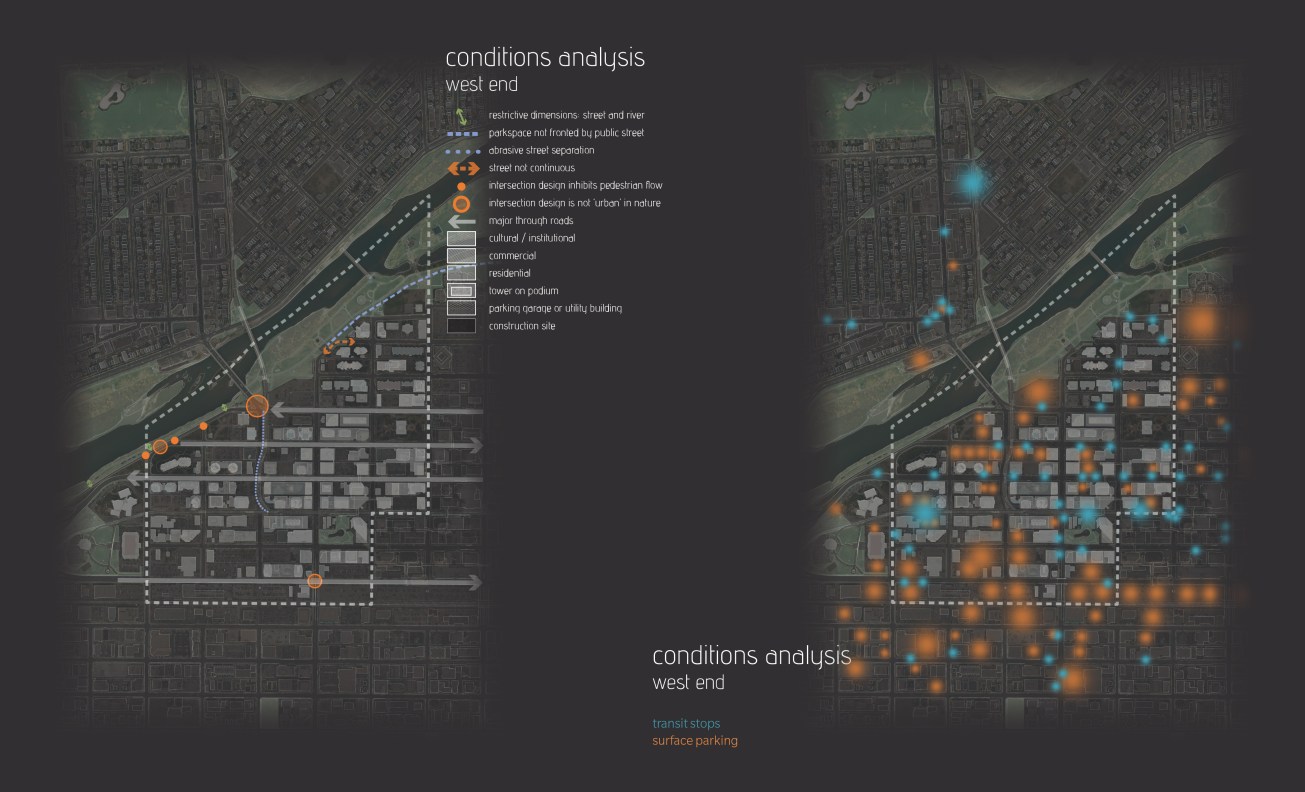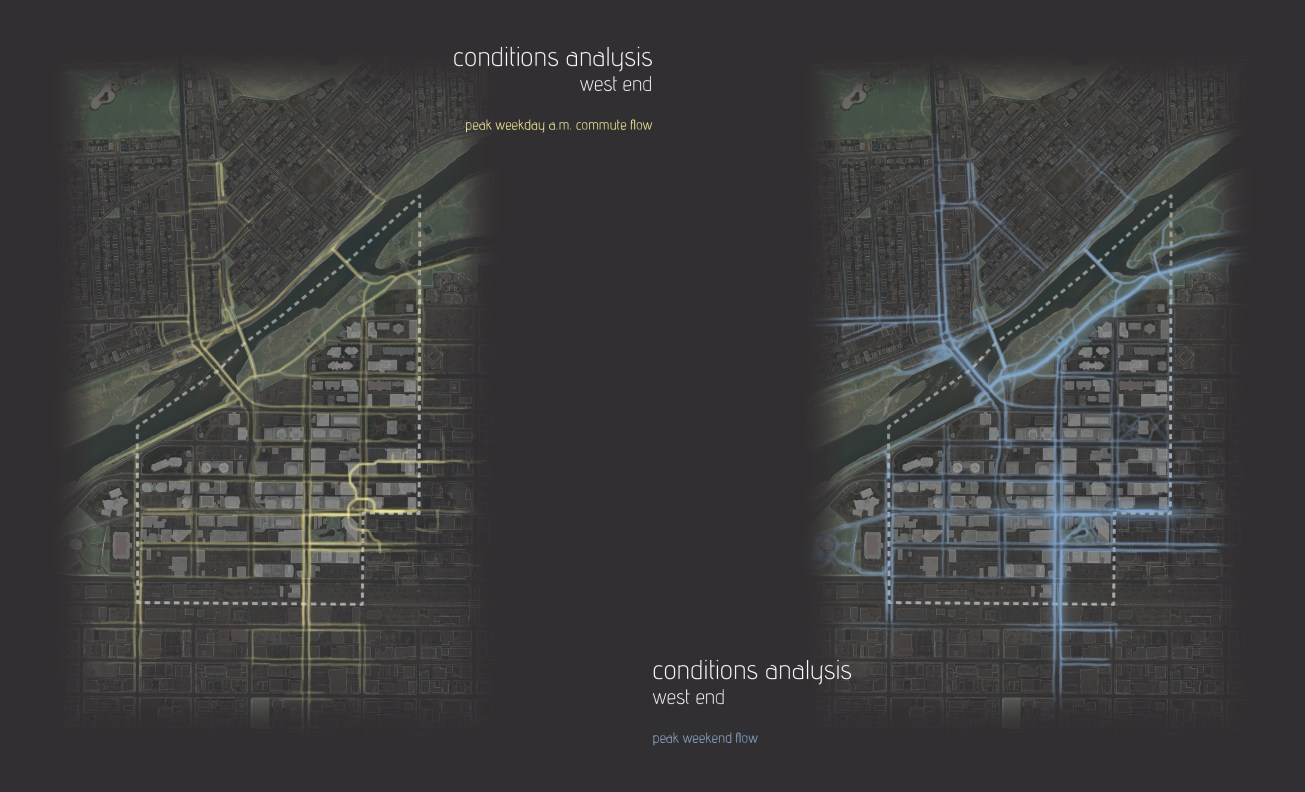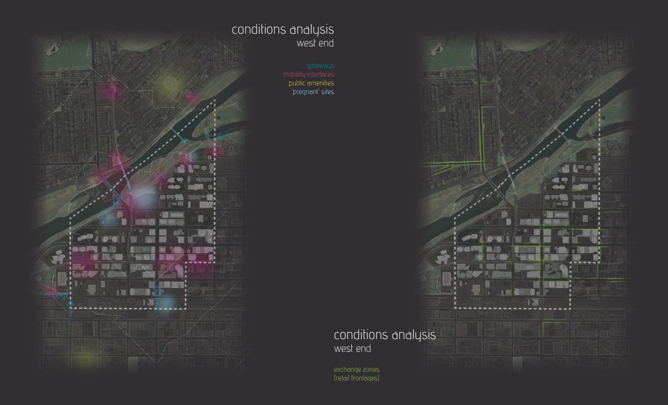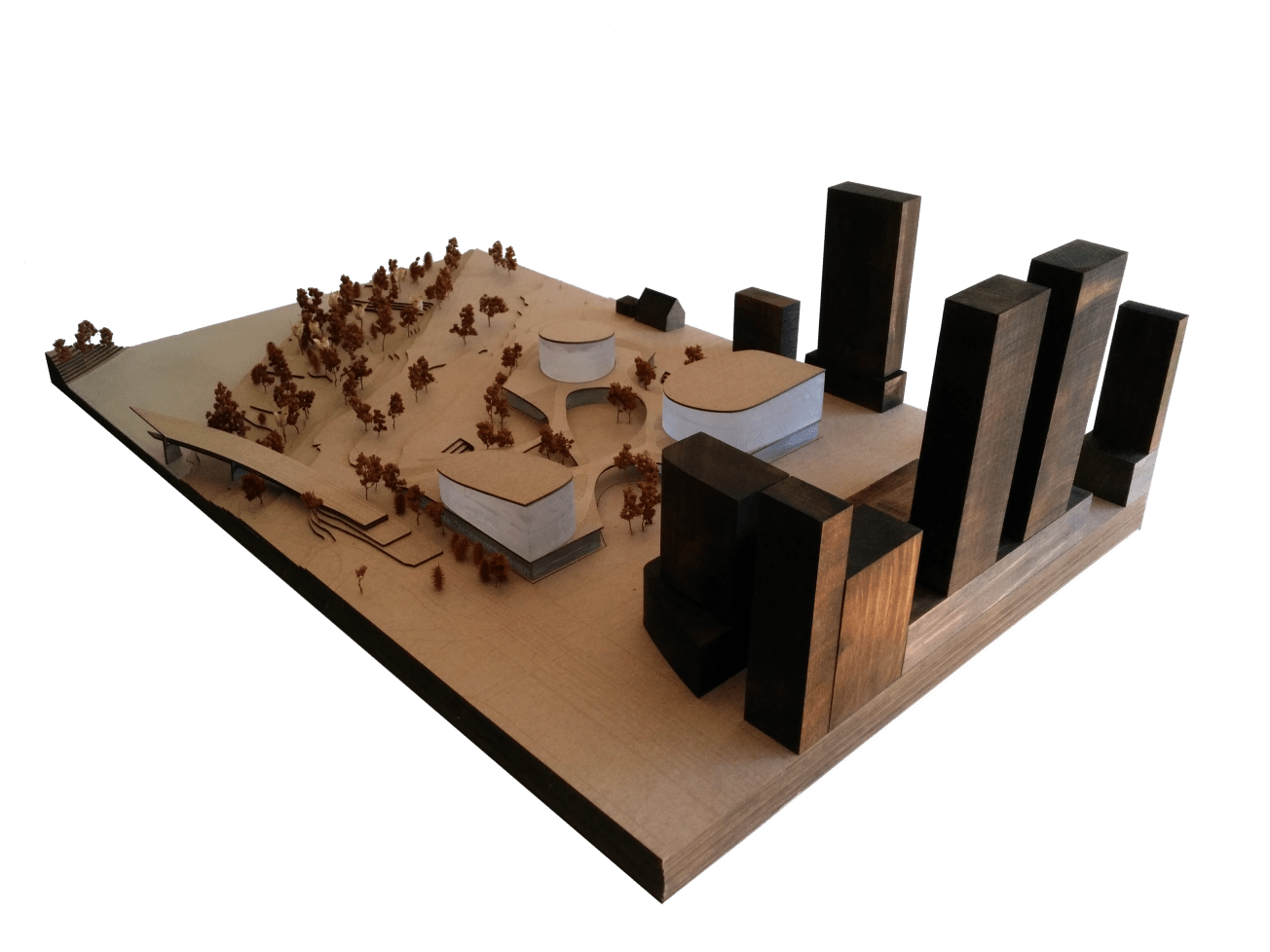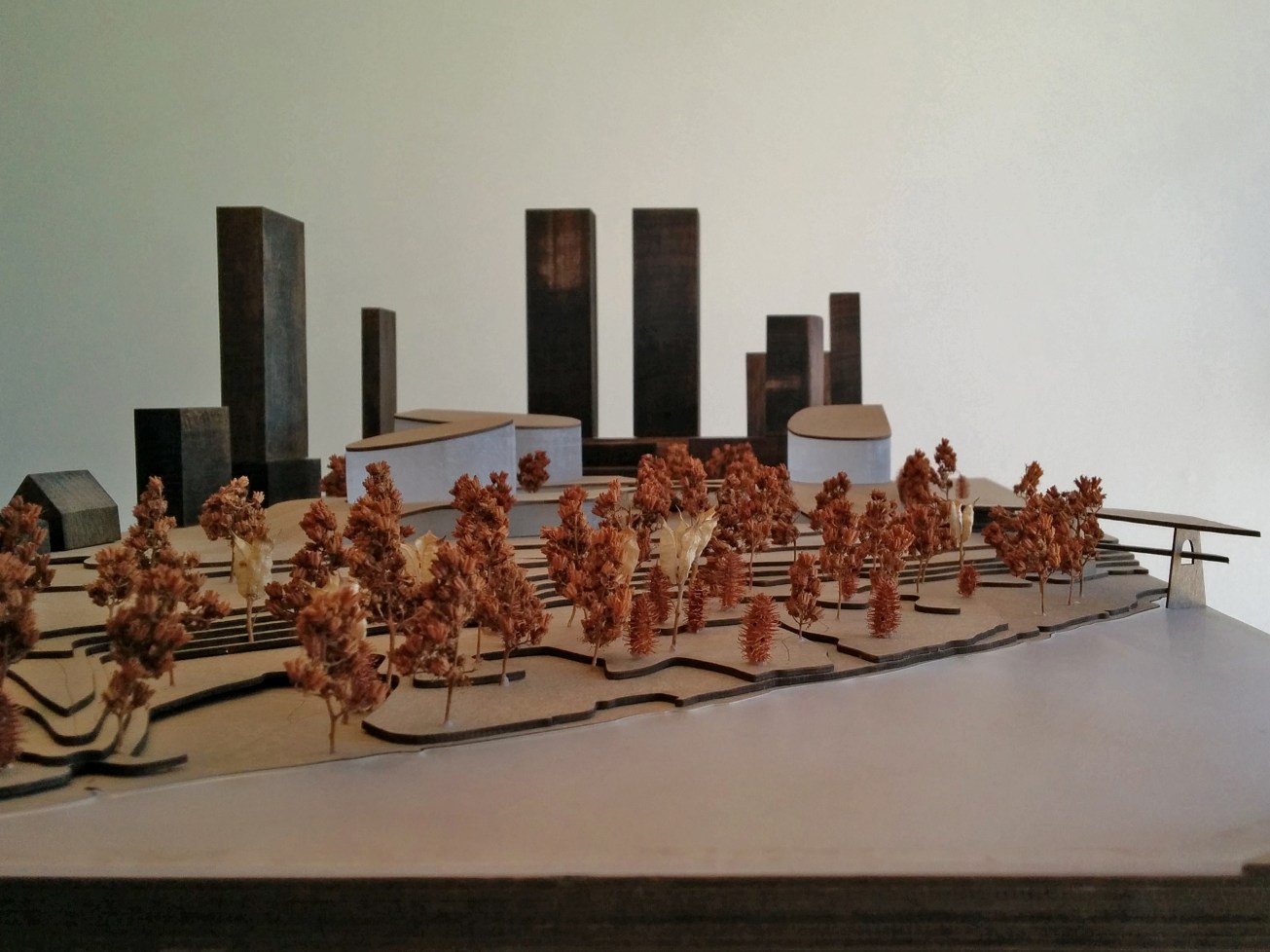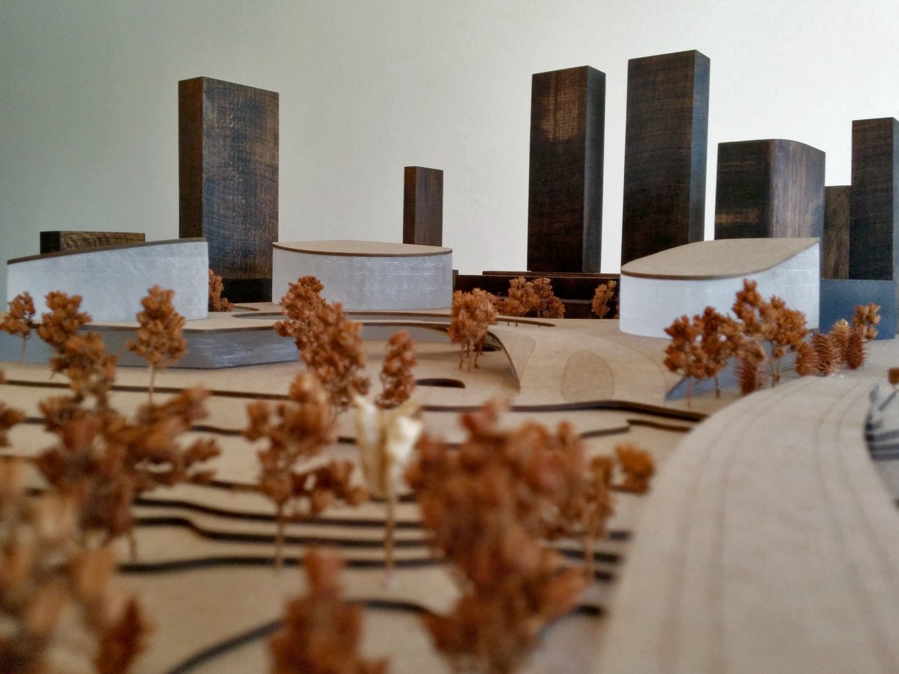
Through a thorough analysis of the conditions and relationships between public space and public architecture in the west end of downtown Calgary, this project seeks to position three major pieces of public architecture—a market, a community centre, and a recreation centre—along with a major public space, in the position of greatest potential. This potential is believed to largely exist due to the selected site’s unique overlaps, intersections, congestions, or dialogues, of multiple mobilities: the LRT, major and minor roads, as well as cycling and pedestrian pathways. In addition, the site’s unique position, being embedded in both urban and landscape conditions allows the design to take on an iconic role and become a prominent piece of the City’s architectural identity from multiple vantage points and for multiple types of users.
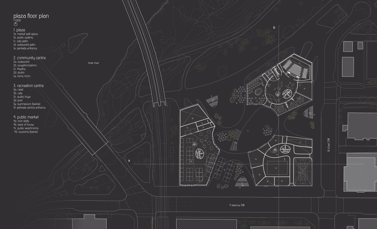
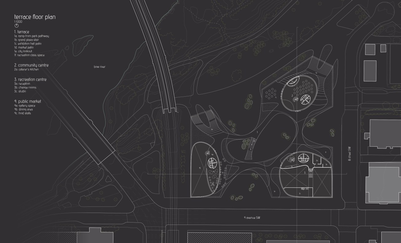
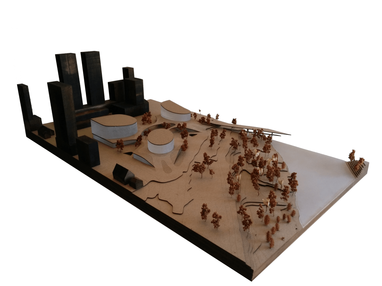
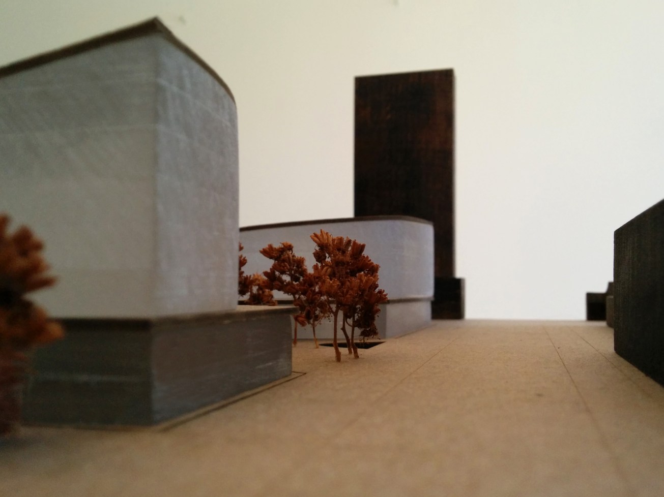
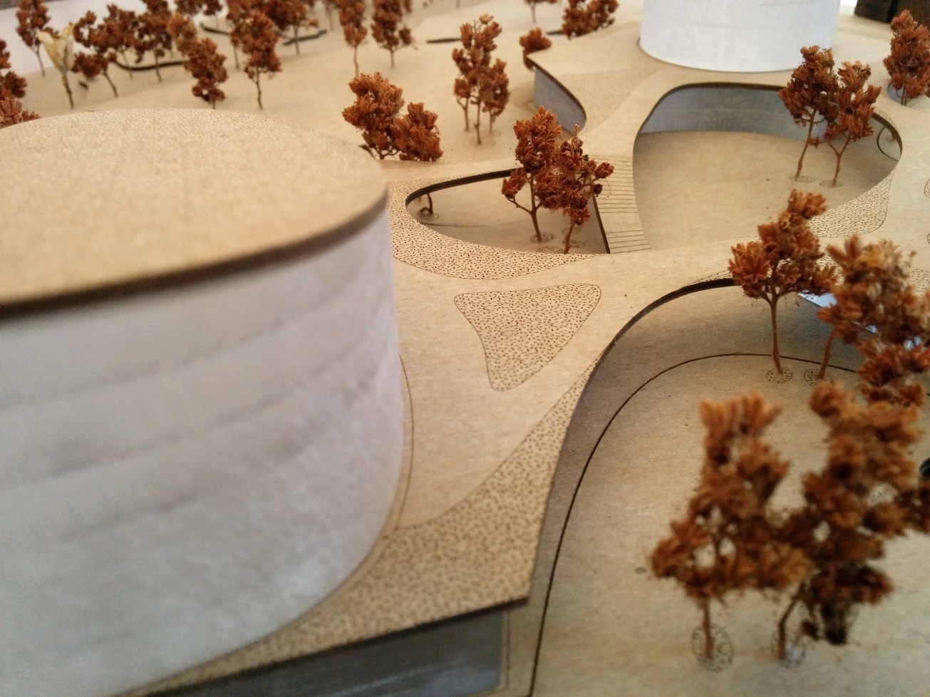
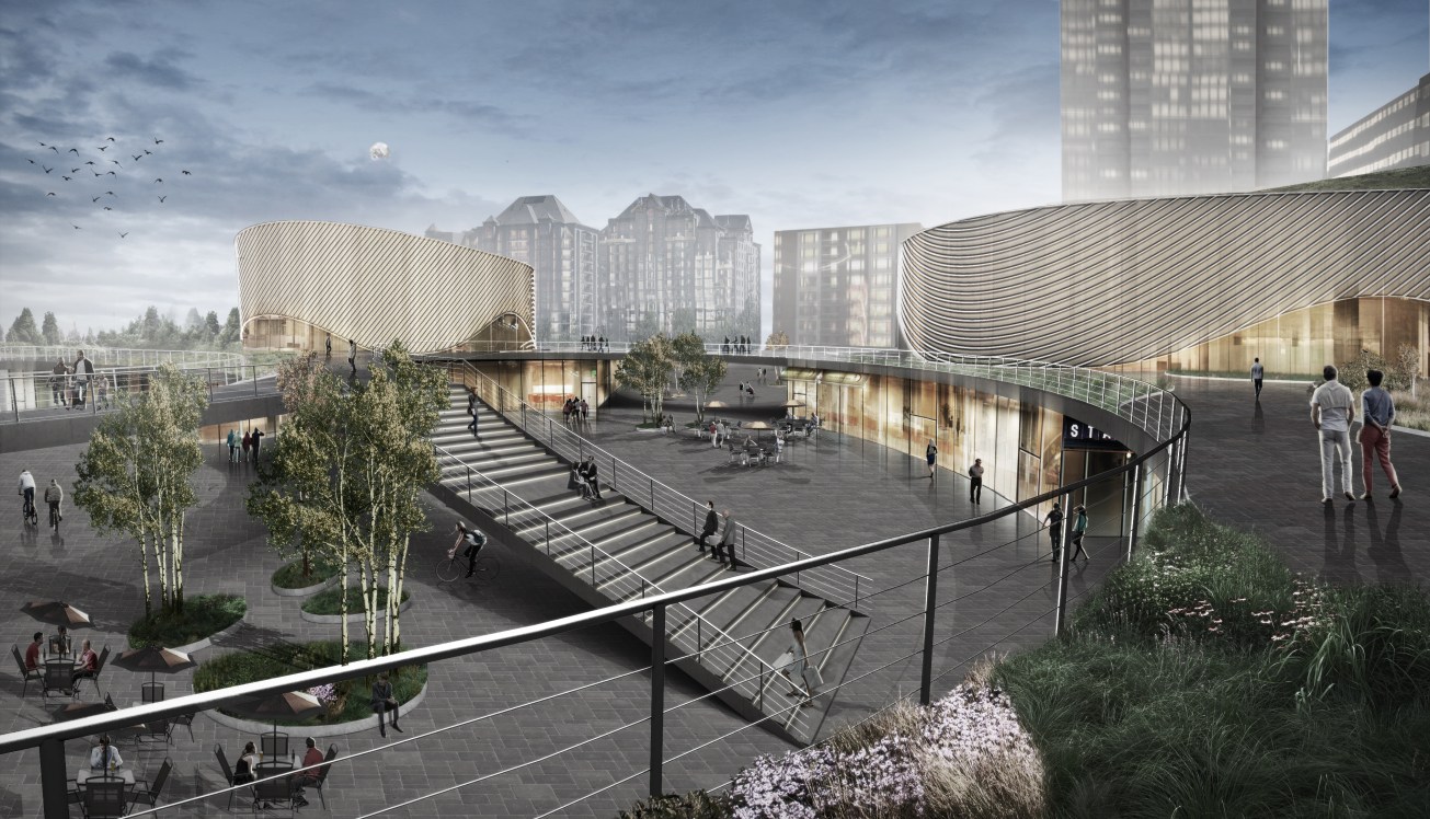
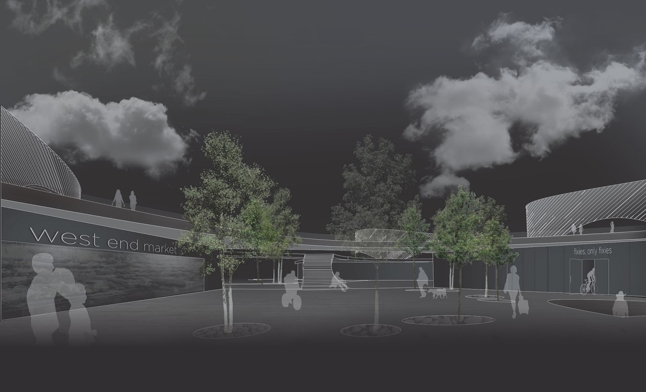
The design of the project seeks to interconnect the two conditions mentioned above (urban and landscape) by intricating the interfaces between them. By doing this, while maintaining a degree of restraint, the types of relationships between the urban, landscape, and architecture are maximized, and their interfaces are allowed to take on multiple roles and identities. For example, when entering the site from the southeast, the project takes on a very urban role both formally, in its field within figures relationship, and programmatically, in its rich and varied diversity; however, when entering from the northwest, the project takes on a landscape role, both formally, with its figures within field relationship, and in program, with its bifurcating smoothly curved pathways, and unfolding programmatic density. This contextual duality results in a hybrid condition at the heart of the project, where the role of public architecture and space overlap creating a figurated field.
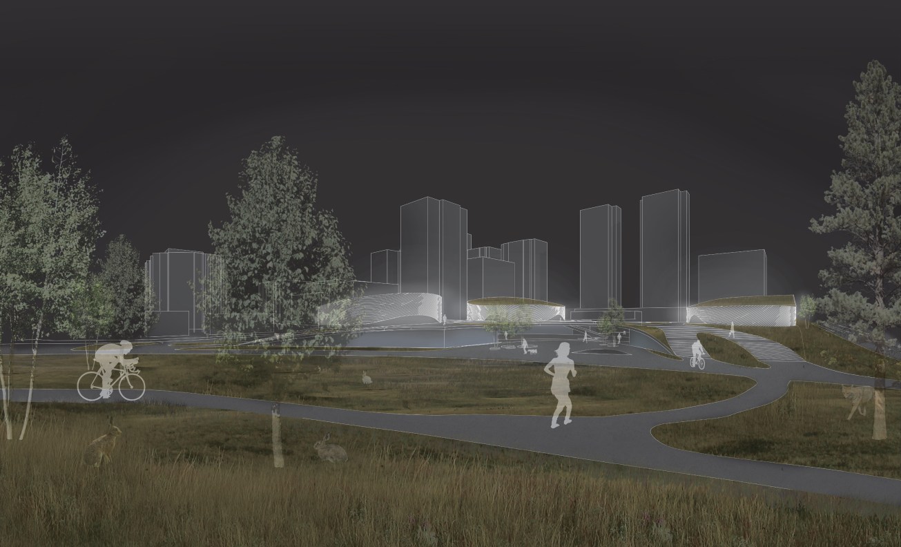
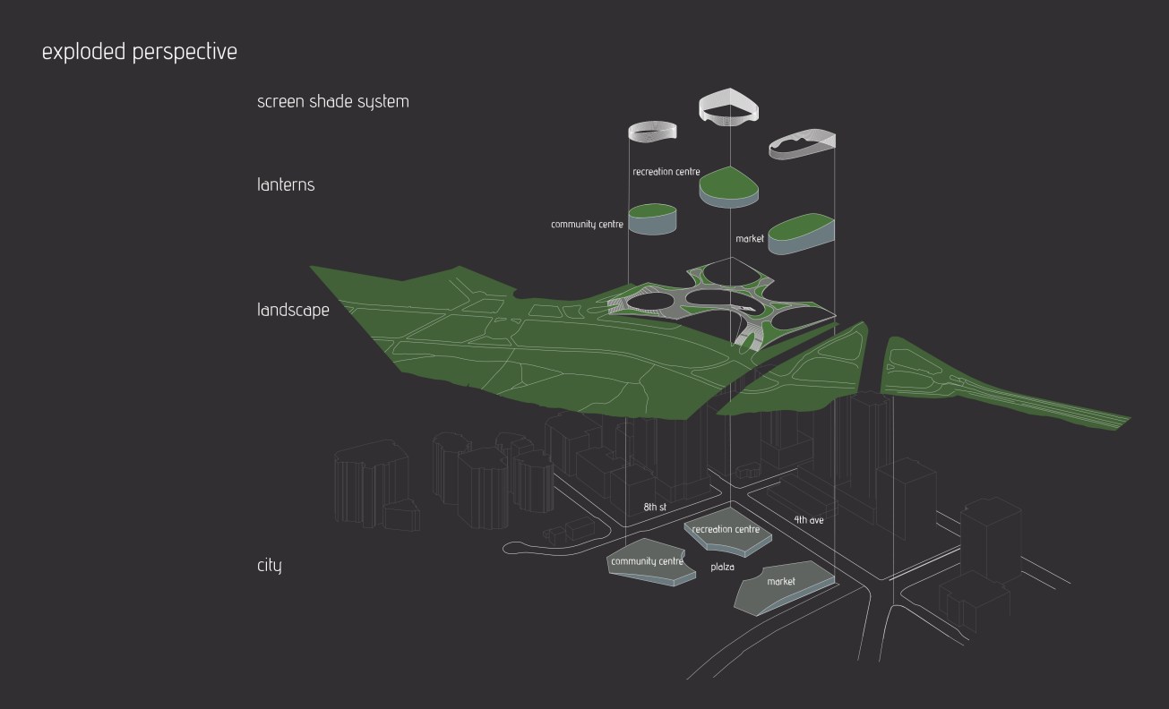
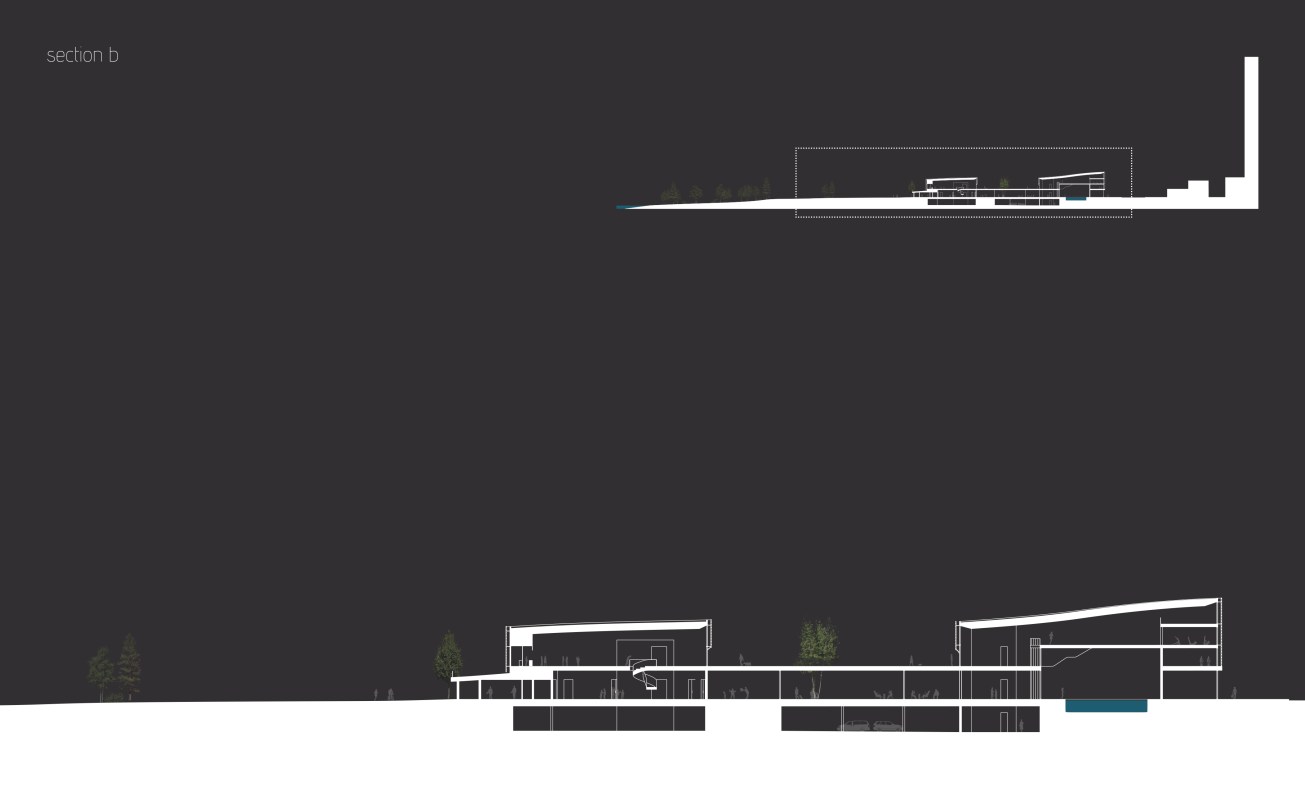
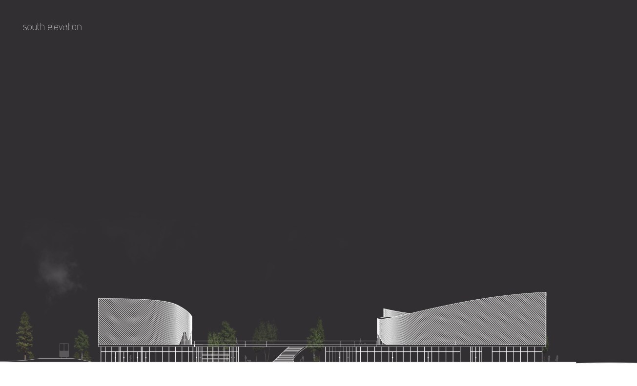
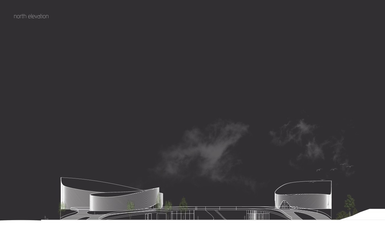
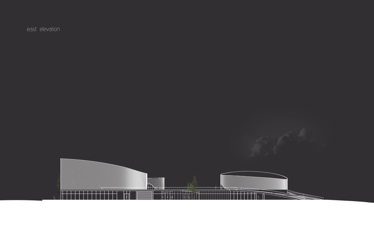
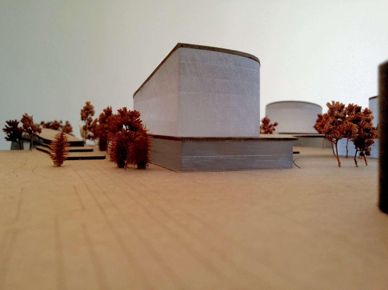
At the landscape scale, seen from the LRT bridge, across the Bow River along Memorial Drive, or the City’s regional pathways, the figures that protrude above the canopy create a unique moment in the city. Here subdued yet iconic curved masses protrude from the prairie grass landscape, glowing like soft lanterns amongst the repetitious pixilated windows of the skyline. From the city scale, these lanterns rest above an amenity rich glazed podium, offering a guiding visual gateway to both the project’s interior, and to the softer urbanity beyond the core.
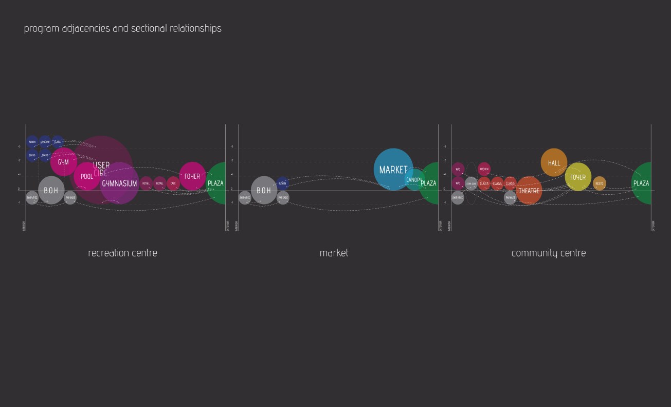
Through the use of public programs and architectures of the ‘everyday’—the market, community centre, and recreation centre—this project seeks to engender a collective or public identity that is rooted in the unpretentious actions interwoven into the routines of the multitude of communities that overlap the spaces of the contemporary city. It is hoped that within this space, where the city and landscape meet, where the multiple paths of the multitude intersect in a unique dialogue, a more collective understanding of what is public, and what is the public good, can begin to mature.